
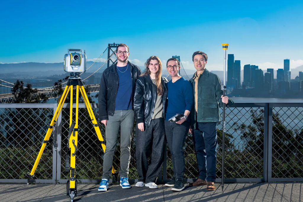
San Francisco startup Mach9 has closed a massive $34 million Series A funding round after pulling off one of the smartest strategic pivots in recent tech history. The funding round was co-led by heavyweight venture capital firms First Round Capital and Bessemer Venture Partners, with substantial participation from Prudence and existing backer Quiet Capital.
The cash injection lands at a time when venture capitalists are becoming far more selective about artificial intelligence investments. Investors are no longer throwing money at every generic chatbot that pops up. Instead, major capital is flowing into specialized tools that solve painful, expensive problems in foundational industries. Mach9 found its sweet spot by targeting a corner of the economy that touches everything around us but rarely grabs the front page: civil engineering, land surveying, and infrastructure design.
What makes this $34 million raise stand out is not just the dollar amount. It is the story behind how the company got here. Mach9 began its journey trying to build physical hardware and mapping robots. When the founders realized that hardware was not the real bottleneck slowing down public projects, they made a daring call. They abandoned the hardware, dropped the word robotics from their corporate name, and pointed their artificial intelligence straight at computer-aided design (CAD) software. That gamble has now paid off in a big way.
The Pivot That Changed Everything: Why Mach9 Walked Away from Robotics
Mach9 was originally founded in 2021 under the name Mach9 Robotics. The founding team came out of Carnegie Mellon University’s famous Robotics Institute, bringing along technical pedigree from places like Tesla, SpaceX, NASA, Apple, and Google X. With backgrounds rooted in building physical navigation systems, their first instinct was familiar: construct advanced hardware platforms to map environments in three dimensions.
As the team spent time in the field with surveying crews and civil engineering contractors, they noticed an unexpected pattern. Companies already possessed top-tier laser scanners, drones, camera rigs, and mobile mapping trucks. Hardware manufacturers like Leica, Trimble, and RIEGL had spent decades perfecting reality capture equipment. A single truck mounted with high-end sensors could drive down a highway corridor and capture millions of laser measurement points in just a few hours.
The $0 Secret To Launching Your Entire Online Empire
Why pay hundreds every month for separate software? Build funnels, send emails, and make sales with Systeme.io completely free.
Get Started For $0Free Forever • No Credit Card Needed • Beginner-Friendly
The real breakdown happened the moment that truck drove back to the office.
Surveyors and civil engineers were drowning in raw data. Field teams could gather terabytes of sensor measurements in a single afternoon, but engineering teams spent weeks or months clicking mouse buttons inside legacy CAD programs to make sense of it. The hardware was flying at high speed, but the office drafting work was crawling at a snail’s pace.
Co-founder and chief executive officer Alexander Baikovitz saw that building yet another sensor rig was not going to fix the industry. The real wall holding back new roads, water pipelines, bridges, and power lines was the slow, manual drafting process. Baikovitz and his team decided to strip “Robotics” from the company name, retire their hardware ambitions, and focus 100 percent of their energy on writing smart AI drafting software.
Making that kind of mid-course correction requires serious courage. Walking away from your initial hardware investments to rewrite your business model can easily sink an early-stage startup. In Mach9’s case, it opened the door to exponential customer demand and caught the attention of Silicon Valley’s top investors.
What Is CAD and Why Is Traditional Drafting So Painfully Slow?
To understand why investors just handed Mach9 $34 million, you have to look at how infrastructure projects actually get built.
Before a construction crew can pour concrete for a highway expansion, fix an aging bridge, or install new fiber optic cables, engineers need an exact, centimetre-accurate drawing of the existing land. This drawing is created using Computer-Aided Design software, commonly known as CAD. The file maps out every single detail on the ground:
- The exact slope and curves of the road surface
- Curbs, gutters, and pavement edges
- Painted traffic lines and crosswalks
- Utility poles, streetlights, and traffic signals
- Storm drains, manhole covers, and fire hydrants
- Trees, fences, and nearby building foundations
For decades, the standard way to map these sites was traditional surveying. A crew of workers stood along the road wearing high-visibility vests, holding tall measurement poles, and manually shooting points one by one with an optical instrument. It was slow, weather-dependent, and dangerous for crews working near fast traffic.
Reality capture changed the first half of that process. By mounting light detection and ranging (LiDAR) scanners and high-resolution cameras on vehicles or drones, surveyors began collecting millions of 3D points, known as a point cloud.
The trouble is that a point cloud is not a blueprint. It is simply a massive, noisy swarm of floating dots in digital space. A standard CAD program cannot automatically tell the difference between an asphalt curb, a patch of tall weeds, a guardrail, or a passing dog.
As a result, engineering firms had to hire human CAD technicians to sit at computer monitors for forty hours a week, zooming in on massive point clouds and manually tracing lines over every curb, paint strip, and manhole cover. In traditional drafting setups, tracing just one single mile of a standard roadway takes roughly an entire week of dedicated human labor.
When an engineering firm wins a contract to survey fifty or a hundred miles of highway, the drafting phase alone can drag on for months. This creates an enormous bottleneck that delays construction timelines, burns client budgets, and prevents engineering teams from taking on new work.
Inside Mach9: How AI Turns Months of CAD Tracing into Minutes
Mach9 created a web-based platform called Digital Surveyor to wipe out this drafting backlog. The software acts as an intelligent assistant that takes raw reality-capture data and automatically drafts finished CAD drawings.
The workflow is built to fit cleanly into how engineering firms already operate:
1. Uploading Raw Field Data
Engineering teams do not need to buy proprietary cameras or change their field routines. Mach9 is hardware-agnostic, meaning it accepts data from virtually any major scanner brand, including Leica, Trimble, RIEGL, NavVis, and Phoenix. Teams simply upload their mobile, terrestrial, or drone point clouds and aerial images directly into the platform through a standard web browser.
2. Automated AI Extraction
Once the scans are loaded, Mach9’s proprietary AI models analyze the point cloud. Unlike general-purpose machine learning tools that guess or summarize, Mach9’s vision models are specifically trained on physical infrastructure geometry. The software scans the point cloud and automatically extracts:
Send, Spend & Hold Money Worldwide Without Hidden Fees
Transfer money internationally at the real exchange rate and hold 40+ currencies in one account.
Open a Wise AccountMid-market rate • Fast transfers • 40+ currencies
- Breaklines and surface topography
- Road edges, curbs, and lane markings
- Utility poles, signage, and street furniture
- Overhead utility wires and clearance heights
- Drainage structures and surface contours
Instead of a technician spending days tracing lines by hand, the software generates a detailed, engineering-grade vector draft across miles of terrain in a matter of minutes.
3. Human Quality Control and Refinement
In civil engineering, mistakes can lead to structural failures, budget disasters, or serious safety hazards. Mach9 does not expect engineers to trust an algorithm blindly.
The platform includes built-in quality control tools that flag areas where sensor data was sparse, obstructed by traffic, or ambiguous. Human surveyors and technicians review the draft, inspect flagged zones, nudge vertices where necessary, and apply professional judgment. Technicians retain complete control, but instead of drawing everything from scratch, they act as editors reviewing an already accurate blueprint.
4. Seamless Industry Export
Once approved, the file exports directly into the formats engineers already use daily, such as DXF, DGN, and Esri GIS layers. The drawing drops right into established design software packages like Autodesk Civil 3D or Bentley MicroStation without requiring teams to retrain their entire workforce on unfamiliar file formats.
10x Faster at One-Fifth the Cost: The Cold, Hard Data
Startup claims can often sound exaggerated, but Mach9 backed up its Series A pitch with extensive real-world usage figures gathered during its private beta phase.
The platform has already been deployed across more than 2,500 real-world projects in all 50 US states. Through those contracts, the software has processed surveys covering over 100,000 miles of infrastructure. Nearly 100 commercial customers, including major survey outfits and engineering design firms, have integrated the system into their daily workflows.
The operational gains reported by these early adopters are dramatic:
- Ten times faster feature extraction: Jobs that previously tied up a technician for several weeks are regularly completed in two or three days.
- One-fifth the drafting expense: By eliminating hundreds of hours of manual clicking, the operational cost to produce an engineering deliverable drops by up to 80 percent.
- Tackling the labor shortage: Many civil engineering firms struggle to recruit qualified drafting technicians. Automating the baseline extraction allows existing staff to produce several times more finished deliverables without working overtime.
When local governments and private utilities plan large-scale updates, saving weeks on preliminary design means shovels hit the ground faster. Whether replacing drinking water lines, repairing bridges, or deploying rural broadband, trimming months off the planning phase saves taxpayers and utility customers significant money.
Silicon Valley’s Billion-Dollar Pivot to “Boring” Industries
Mach9’s successful funding round highlights a broader shift taking place across the venture capital landscape. Over the past two years, public attention has been consumed by consumer chatbots, generative art platforms, and viral text tools. However, seasoned enterprise investors are directing their largest checks toward what some call “boring AI”—software that automates specialized, unglamorous workflows inside massive traditional industries.
We are seeing this trend across multiple sectors. For instance, as tracked in our look at how AI is becoming the ultimate first hire for businesses, organizations are eager for tools that perform tangible work rather than just generating conversational text. Similarly, our coverage of Google’s universal task agents highlighted how the entire tech ecosystem is pushing toward software that can execute complex, multi-step professional operations autonomously.
The $0 Secret To Launching Your Entire Online Empire
Why pay hundreds every month for separate software? Build funnels, send emails, and make sales with Systeme.io completely free.
Get Started For $0Free Forever • No Credit Card Needed • Beginner-Friendly
Enterprise spending on artificial intelligence is surging because corporate clients demand demonstrable returns on investment. Companies are happy to pay premium subscription fees for software that demonstrably shaves weeks off project delivery schedules. As highlighted when Anthropic revenue surged past $11.5 billion, the enterprise appetite for reliable, mission-critical AI infrastructure is breaking historical records.
At the same time, this surge in practical software is creating immense demand for computing capacity. The tech world is keeping a close watch on infrastructure, as detailed in our analysis of why big investors worry about pushback against AI data centers. The companies generating the highest returns on that computing power are those applying it to high-value industrial problems, echoing the trends explored in our breakdown of Wall Street’s trillion-dollar AI bets. Even across emerging markets, startup ecosystems are bouncing back by focusing on practical value creation, as seen in the recent report on African startups raising billions across hundreds of deals.
Civil engineering represents an ideal proving ground for this shift. Global infrastructure spending is measured in trillions of dollars each year. Yet, much of the planning and drafting work inside engineering firms has remained fundamentally unchanged since desktop computers replaced drafting tables in the 1990s. By modernizing that workflow, Mach9 is positioning itself at the center of an enormous market.
Will AI Put Human Surveyors and Draftspeople Out of Work?
Whenever artificial intelligence automates a technical task, questions about job security immediately follow. Is Mach9 going to eliminate the need for civil engineers and land surveyors?
The short answer is no, but the nature of the daily work is going to change significantly.
Right now, the civil engineering industry is wrestling with a severe demographic crunch. A large portion of experienced licensed surveyors and senior drafters are nearing retirement age. Meanwhile, fewer young graduates are entering the profession to replace them. Trade associations have spent years sounding the alarm about a critical lack of skilled technicians capable of handling incoming infrastructure workloads.
Because of this shortage, engineering firms regularly turn down lucrative projects simply because they do not have enough internal capacity to produce the required CAD drawings on time. Technicians are forced to spend long days performing repetitive, pixel-by-pixel tracing work that leads to physical strain and creative burnout.
By handling the mechanical tracing work, software like Mach9 transforms the role of a drafter into that of a quality-assurance inspector and systems designer:
- Technicians spend less time clicking repetitive points and more time solving design challenges.
- Licensed surveyors can focus on verifying legal boundary determinations, complex elevations, and safety standards.
- Engineering firms can bid on four to five times more infrastructure contracts without needing to double their headcount.
Rather than destroying jobs, the software expands the operational capacity of existing teams. It allows infrastructure planning to keep pace with demand, ensuring that bridge inspections, highway expansions, and water system improvements move forward without stalling for months in an office drafting queue.
What Lies Ahead for Mach9 and Modern Infrastructure
With $34 million in fresh capital sitting in the bank, Mach9 plans to scale its engineering organization and broaden the capabilities of its software platform.
A primary objective is expanding beyond traditional road corridors and surface transport networks. The startup is refining its computer vision models to map complex underground utility networks, electrical substations, rail transit corridors, and water treatment facilities. Each of these specialized environments presents unique sensor challenges, requiring algorithms that can interpret cluttered, low-light, or partially obstructed physical assets with dependable accuracy.
Another strategic priority is deepening integrations with legacy software ecosystems. Companies like Autodesk and Bentley Systems have maintained an iron grip on the civil infrastructure design market for decades. Rather than attempting to convince thousands of conservative engineering firms to abandon their primary drafting environments, Mach9 is ensuring its AI output flows effortlessly into existing CAD software stacks. By serving as an intelligent drafting engine that feeds existing software tools, Mach9 lowers the friction required for large engineering firms to adopt its technology.
As governments around the world commit record funding to rebuild aging physical infrastructure, the companies that can accelerate project delivery timelines will hold an immense advantage. By recognizing early on that software, rather than hardware, was holding the entire industry back, Mach9 has positioned itself at the cutting edge of a multi-billion-dollar transformation.
Frequently Asked Questions (FAQs)
What is Mach9?
Mach9 is a San Francisco-based software company that creates artificial intelligence tools for civil engineering and surveying. Its flagship platform, Digital Surveyor, automatically converts raw 3D laser scans (LiDAR) and imagery into centimetre-accurate CAD drawings.
How much money did Mach9 raise in its latest round?
Mach9 raised $34 million in a Series A funding round co-led by First Round Capital and Bessemer Venture Partners, with participation from Prudence and Quiet Capital.
Why did Mach9 pivot away from robotics?
The company was originally founded in 2021 as Mach9 Robotics to build mapping hardware. The founders realized that high-quality scanning hardware was already widely available, but turning those scans into CAD drawings was an agonizingly slow manual process. They dropped “Robotics” from their name and redirected their focus toward developing AI drafting software to solve that drafting bottleneck.
Does Mach9 replace human civil engineers?
No. Mach9 creates the initial vector draft from 3D scans, but licensed surveyors and civil engineering technicians still review the drawings, check flagged anomalies, and make necessary adjustments. The software removes repetitive manual tracing so engineers can deliver projects faster and take on more client work.
What kind of hardware does Mach9 support?
Mach9 is hardware-agnostic. It can process point clouds and images collected by major scanner brands such as Leica, Trimble, RIEGL, NavVis, and Phoenix, whether gathered via mobile vehicle rigs, aerial drones, or tripod-mounted terrestrial scanners.
Which file formats can Mach9 export to?
The platform exports drawings directly into widely used industry formats, including standard DXF, DGN, and Esri GIS layers, allowing seamless integration with traditional CAD programs like Autodesk Civil 3D and Bentley MicroStation.
The infrastructure that supports daily life—from the asphalt roads we travel on to the water pipes running beneath our feet—relies on precise spatial measurement. For decades, the process of translating the messy physical world into exact digital blueprints has been slow, expensive, and constrained by manual labor. Mach9’s $34 million Series A funding round proves that solving real-world friction with specialized AI is where the future of technology truly lies. By swapping hardware ambitions for intelligent drafting software, the startup is helping civil engineers build and repair the physical world faster than ever before.
