
Chinese space scientists have successfully tested a new star-based navigation system in space. This technology brings a theoretical concept originally designed by NASA—known as StarNAV—into real-world operation.
By looking at subtle shifts in starlight, spacecraft can now calculate their speed, direction, and location all on their own without needing constant directions from ground stations on Earth.
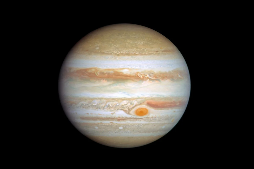
This orbital test marks a giant leap forward for deep-space travel. China is preparing for an ambitious interplanetary mission to Jupiter around 2030. At distances that far, radio signals take nearly an hour to travel back and forth. Having a ship that can drive itself through the solar system is no longer just a cool science fiction idea. It is an absolute necessity.
The initial space test proved that onboard cameras tracking distant stars can pinpoint a satellite’s location with impressive precision. It opens up an entirely new way for humanity to explore the outer edges of our solar system.
What Is Stellar Aberration Navigation?
Navigating through deep space is much harder than finding your way on Earth. Down here, we rely on GPS satellites, physical roads, and landmarks. Out in the void between planets, there are no road signs, no magnetic north, and no simple way to drop a pin on a map.
The $0 Secret To Launching Your Entire Online Empire
Why pay hundreds every month for separate software? Build funnels, send emails, and make sales with Systeme.io completely free.
Get Started For $0Free Forever • No Credit Card Needed • Beginner-Friendly
For decades, space agencies have relied on massive radio dishes on Earth to track probes. These ground stations send radio signals out to the spacecraft, wait for a response, and measure how long the signal took to return. While this works well for close targets like the Moon or Mars, it gets much harder when you send probes farther into the solar system.
That is where stellar aberration navigation comes in.
The Science Behind Starlight Shifts
Stellar aberration sounds like a complicated term, but the core idea is simple. You can picture it by imagining you are standing outside in a heavy rainstorm.
If you stand completely still, rain falls straight down on top of your umbrella. But if you start running forward, the raindrops appear to hit you from an angle in front of you. To stay dry, you have to tilt your umbrella forward. The faster you run, the more you have to tilt your umbrella.
Light from distant stars acts in a similar way. Stars emit beams of light that travel across space. When a spacecraft is motionless, those light beams strike the ship’s cameras at a straight, predictable angle.
When the spacecraft speeds up or changes direction, the light rays appear to shift slightly. This slight shift in the position of stars is called stellar aberration.
By using specialized digital sensors to measure these tiny changes in starlight angles, a computer on board the spacecraft can calculate its exact velocity and trajectory in real time. The stars themselves act as a universal GPS grid that never turns off.
The Tianhui-7 Satellite Test That Proved the Concept
To turn this theory into reality, Chinese engineers performed an experimental flight test in orbit using the Tianhui-7 satellite.
During the test in low Earth orbit, the satellite turned its optical sensors toward deep space. It captured images of distant stars, measured the subtle light shifts, and ran the navigation algorithms directly on its internal processor.
The results of the test were impressive. The onboard star system determined the satellite’s position with an accuracy of around 5 kilometers (3.1 miles).
While 5 kilometers might sound like a big distance on Earth, it is extremely precise when traveling millions of kilometers through space. In fact, that level of precision matches what ground-based dish networks achieve when tracking deep-space probes.
According to reports published by the South China Morning Post and summarized by science outlets like The Daily Galaxy, this marks one of the clearest demonstrations of star-based velocity navigation in orbit.
How It Compares to Ground-Based Navigation
For the past sixty years, deep space exploration has depended almost entirely on ground networks like the NASA Deep Space Network. The Deep Space Network uses giant antenna dishes located in California, Spain, and Australia to keep eyes on missions across the solar system.
Ground tracking networks are great, but they face clear physical limits:
- Ground stations are expensive to build, maintain, and power.
- There are only so many dish antennas available on Earth, creating a bottleneck as more countries launch space probes.
- Ground teams must manually schedule tracking time for each individual mission.
- Radio signals lose strength over massive distances, requiring enormous amounts of energy to send data across space.
By allowing a spacecraft to handle its own tracking using lightweight cameras and computers, space agencies can free up ground antennas for scientific data downloads instead of routine location checks.
Send, Spend & Hold Money Worldwide Without Hidden Fees
Transfer money internationally at the real exchange rate and hold 40+ currencies in one account.
Open a Wise AccountMid-market rate • Fast transfers • 40+ currencies
Why Deep Space Missions Need Autonomous Navigation
Sending a mission to the outer solar system is completely different from sending a satellite into Earth orbit or making a quick trip to the Moon. Once a spacecraft passes Mars, the sheer scale of space creates massive challenges.
Jupiter sits roughly 600 million to 900 million kilometers away from Earth, depending on where both planets are in their orbits. Light and radio waves travel at roughly 300,000 kilometers per second. At that speed, a radio command sent from Earth takes over 50 minutes to reach a spacecraft near Jupiter.
If the ground control center sends a message asking “Where are you?”, it takes 50 minutes for the message to get to the ship, and another 50 minutes for the answer to come back. That is a round-trip delay of nearly two hours.
Split-Second Decisions in Deep Space
Imagine driving a car down a mountain road where every turn you make with the steering wheel takes two hours to actually happen. That is what controlling a distant spacecraft feels like from Earth.
During crucial moments of a mission, waiting two hours for a response is impossible:
- Entering orbit around Jupiter requires firing thrusters at an exact moment to slow down. Missing the mark by even a few seconds could cause the probe to bounce off into deep space or crash into the planet.
- Flying past small moons requires precise steering adjustments to capture close-up photos without colliding with space debris.
- Adjusting flight paths during solar storms requires immediate reactions to protect sensitive scientific instruments.
An onboard system using stellar aberration navigation can make these course corrections instantly without waiting for permission from Earth. The spacecraft simply looks at the stars, figures out its location, and corrects its own path automatically.
As autonomous systems continue to transform industries—a trend we cover extensively in our technology and AI updates—it is clear that space exploration is heading toward total self-reliance.
China’s Ambitious Jupiter Mission: What We Know
China has been rapidly expanding its space capabilities over the past decade. After successful robotic landings on the Moon and Mars, the country set its sights on the outer planets.
The upcoming mission to Jupiter is tentatively known as Tianwen-4, though it is also commonly referred to as the Gan De mission.
The mission is named after Gan De, a famous Chinese astronomer from the 4th century BCE who recorded detailed observations of Jupiter and may have spotted one of its moons with the naked eye long before telescopes were invented.
The $0 Secret To Launching Your Entire Online Empire
Why pay hundreds every month for separate software? Build funnels, send emails, and make sales with Systeme.io completely free.
Get Started For $0Free Forever • No Credit Card Needed • Beginner-Friendly
Targeted for launch around 2030, this mission is built around an ambitious flight plan:
A Two-in-One Space Mission
Instead of sending just one probe to study a single target, China plans to launch two main spacecraft together on a single heavy rocket.
- The Main Jupiter Orbiter: This spacecraft will fly directly to the Jovian system, entering orbit around Jupiter to study its magnetic field, gas atmosphere, and surrounding moons.
- The Callisto Lander Concept: A secondary craft may attempt to land on Callisto, the outermost of Jupiter’s four main Galilean moons.
- The Uranus Flyby Probe: After separating from the main ship during the long journey, a smaller secondary probe could harvest speed from a planetary flyby and head out toward Uranus.
Why Target Callisto?
Most planetary missions focus on Europa or Ganymede because those moons host deep subterranean ocean environments under their icy crusts. However, Callisto is uniquely attractive for a landing attempt.
Callisto sits far outside Jupiter’s main radiation belt. Jupiter possesses an intense magnetic field that acts like a cosmic microwave, frying electronics on nearby spacecraft. Because Callisto is located farther out, a robotic lander can survive on its surface much longer without being destroyed by radiation.
Callisto also features an extremely old, heavily cratered surface that has remained unchanged for billions of years. Studying its rocks offers scientists a pristine snapshot of what the solar system looked like when it was first forming.
To navigate through Jupiter’s crowded moon system safely, the Tianwen-4 probe will rely heavily on autonomous star-tracking systems to guide its approach.
From NASA Concept to Real Spaceflight
One of the most interesting aspects of this story is where the technology originated. The core concept behind stellar aberration navigation was researched and published years ago by engineers supported by NASA under the project name StarNAV.
NASA scientists realized that measuring the subtle shifts in starlight could give spacecraft an onboard speedometer and map. They published theoretical calculations and ground laboratory studies showing how special cameras could make these measurements.
However, theoretical concepts in space science often sit on shelves for years before someone gets the opportunity and funding to test them on an active satellite in space.
China’s space program took those open scientific principles, built custom onboard hardware and algorithms, and tested the system live in orbit aboard the Tianhui-7 satellite.
This kind of progress shows how space science works globally. Basic research developed in one country can be picked up, refined, and flown in space by researchers in another, ultimately expanding what human technology can accomplish.
Automated systems are reshaping many modern fields today. Just as intelligent code and automated algorithms are changing digital content through YouTube automation tools, smart onboard algorithms are giving spacecraft the freedom to think and navigate for themselves in deep space.
The Growing Role of Autonomous Systems in Deep Space
The success of the Tianhui-7 test is part of a much bigger trend in aerospace engineering. Future space exploration will be defined by intelligent machines that operate without human intervention.
As missions venture farther past Jupiter toward Saturn, Uranus, Neptune, and the Kuiper Belt, ground control radio delays increase from hours to half a day.
Future deep-space explorers will need to handle multiple complex tasks entirely on their own:
- Automatic Hazard Avoidance: Spacecraft landing on moons or asteroids will scan surfaces in real time to avoid boulders, steep cliffs, and soft dust pits.
- Smart Resource Management: Space probes will monitor their own battery power, solar panel degradation, and fuel consumption, adjusting their activities based on current conditions.
- Autonomous Scientific Discovery: Instead of waiting for scientists on Earth to choose photo targets, future probes will use onboard vision tools to identify unusual events—like ice geysers erupting from a moon—and instantly snap high-resolution pictures.
By demonstrating that stellar aberration navigation works reliably in orbit, researchers have provided a vital piece of the puzzle for fully autonomous deep-space probes.
Connecting with Our Community
We love keeping curious minds informed about breakthroughs happening across technology, science, and global news.
If you want to discover more about our platform, meet the team behind our content, or learn how we pick our featured stories, check out our About Page.
Have a question, feedback, or a story tip you think we should cover? You can reach out directly to our editorial team through our Contact Page.
You can also join the conversation and get daily updates by following our official social media channels:
- Connect with us on Instagram for photos, highlights, and behind-the-scenes content.
- Follow our official page on Facebook to comment and share stories with friends.
- Join our community on X (formerly Twitter) for quick updates and breaking news discussions.
Frequently Asked Questions (FAQs)
What is NASA’s StarNAV concept?
StarNAV is a navigation concept originally researched by NASA scientists. It uses optical sensors to measure tiny shifts in the apparent positions of distant stars (stellar aberration) caused by a spacecraft’s movement. By measuring these shifts, the spacecraft can calculate its exact velocity and position autonomously.
How does stellar aberration help a spacecraft find its speed?
Stellar aberration occurs because light moves at a finite speed. When a spacecraft moves quickly through space, light coming from distant stars appears to strike the spacecraft’s cameras at a slightly different angle. By measuring this exact angular shift, onboard computers can determine how fast the ship is moving and in what direction.
Why can’t deep space missions just use Earth’s GPS?
Earth’s Global Positioning System (GPS) relies on a constellation of satellites pointing their signals down toward Earth’s surface. Once a spacecraft travels beyond Earth’s immediate orbit, those GPS signals become far too weak to use. Deep space travel requires looking outward at distant stars rather than depending on satellites orbiting Earth.
How accurate was the Chinese orbital test?
During the test conducted with the Tianhui-7 satellite in low Earth orbit, the star-based navigation system determined the satellite’s position to within about 5 kilometers (3.1 miles). This accuracy matches traditional ground-based radio tracking networks used for deep space exploration.
When is China launching its mission to Jupiter?
China’s planned Jupiter mission, known as Tianwen-4 or Gan De, is scheduled to launch around 2030. The mission aims to study Jupiter and its moons, with a potential landing attempt on Callisto and a flyby probe sent toward Uranus.
The test of stellar aberration navigation aboard the Tianhui-7 satellite represents a true turning point in how humans explore the cosmos. Moving away from heavy reliance on Earth-based dish tracking brings us one step closer to self-navigating spacecraft that can roam the outer solar system freely. As China continues its preparations for the 2030 mission to Jupiter, this NASA-inspired technology will play a central role in helping a robotic probe navigate the vast blackness of deep space all by itself.
