
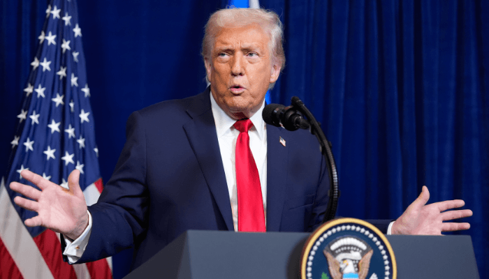
President Donald Trump signed a major executive order directing federal agencies to officially rename Lake Ontario as “Lake America”. The announcement came straight from the Oval Office, where Trump held up a signed document in front of a giant map displaying the new name printed in bold red letters.
The decision has triggered immediate pushback from Canadian leaders, state officials in New York, and international observers. It marks one of the most unusual chapters yet in the growing trade and political disputes between the United States and Canada.
Lake Ontario is shared directly between the state of New York and the Canadian province of Ontario. While a U.S. president can change how federal agencies label geographic features on domestic maps, international boundaries and shared waters carry deep history and legal complexity.
Here is a full breakdown of what happened, why the change was ordered, how Canada and local officials are responding, and what this means for digital maps moving forward.
The Big Oval Office Announcement: What the Executive Order Says
During a press briefing at the Resolute Desk, President Trump signed the paperwork ordering the U.S. Department of the Interior to update federal geographic naming databases. Behind the desk stood a map of the Great Lakes region with the label “Lake America” placed directly over the body of water traditionally known as Lake Ontario.
The $0 Secret To Launching Your Entire Online Empire
Why pay hundreds every month for separate software? Build funnels, send emails, and make sales with Systeme.io completely free.
Get Started For $0Free Forever • No Credit Card Needed • Beginner-Friendly
The order instructs the U.S. Geological Survey (USGS) to update the Geographic Names Information System (GNIS). This database acts as the central naming hub for official U.S. federal maps, government documents, and public records.
Trump stated that the change is effective immediately for U.S. government entities. He explained that federal agencies have already been instructed to update their systems, maps, and official publications over the coming weeks.
During his remarks to reporters, Trump made it clear that the move was closely tied to his ongoing frustration with Canadian trade policies and military spending. He noted that the U.S. holds significant territory along the Great Lakes and argued that American geographic labeling should reflect national interest.
He also hinted that more name changes could follow in the future. Pointing to previous orders regarding surrounding waters, he suggested that the administration might look into updating oceanic names on domestic maps down the line.
Why Is This Happening? The Background Behind the U.S.-Canada Trade War
The decision to change the lake’s label did not happen in a vacuum. It comes during a sharp escalation in trade tension between Washington and Ottawa.
Over recent months, negotiations over cross-border trade agreements broke down. The U.S. government placed 50 percent tariffs on billions of dollars worth of Canadian exports, including steel, aluminum, agricultural goods, and manufactured items.
In response, Canadian Prime Minister Mark Carney announced matching retaliatory tariffs on hundreds of American products. The back-and-forth tariff battle has created serious friction for business owners, farmers, and supply chains on both sides of the border.
Trump voiced his irritation over Canada’s refusal to back down during trade talks. He argued that Canada benefits heavily from trade with the United States while maintaining high tariffs on select American agricultural goods like dairy.
Because diplomatic negotiations stalled, the administration turned toward symbolic measures. Using geographic naming authority is one way the executive branch can apply political pressure without passing new legislation through Congress.
The History of Lake Ontario: Where Did the Original Name Come From?
To understand why this decision has sparked such widespread debate, it helps to look at the history of the name itself. The word “Ontario” long predates modern political borders.
The name comes from the Indigenous Huron-Wendat word Ontari’io. It roughly translates to “lake of shining waters” or “great lake”.
European explorers recorded the name in the 17th century. It was used on maps for more than 400 years before the United States declared independence in 1776 or Canada became a confederated nation in 1867.
The Canadian province of Ontario actually took its name from the lake, not the other way around. Because the name is deeply tied to Indigenous culture and centuries of history, many historians and local leaders view the name as an unchangeable historical fact.
International law also plays a major role here. Under international rules, one country cannot unilaterally change the name of a geographic feature for another sovereign nation. Canada controls the northern half of the lake, meaning Ottawa has no legal obligation to adopt the U.S. label.
How Canada and State Officials Are Responding
The reaction from Canadian leaders was immediate and unified. Prime Minister Mark Carney posted a clear statement online addressing the executive order.
Send, Spend & Hold Money Worldwide Without Hidden Fees
Transfer money internationally at the real exchange rate and hold 40+ currencies in one account.
Open a Wise AccountMid-market rate • Fast transfers • 40+ currencies
Carney highlighted the 400-year history of the name and emphasized its Indigenous roots. He stated firmly that while foreign policies and trade relationships might change, Canadians will continue calling the body of water Lake Ontario now and in the future.
Provincial leaders across Canada expressed similar thoughts:
Ontario Premier Doug Ford
Doug Ford rejected the name change completely. He noted that people across the globe recognize the lake by its historic name and encouraged Canadians to support domestic goods during the trade dispute.
Nova Scotia Premier Tim Houston
Tim Houston called the situation unnecessary foolishness, emphasizing that political squabbles should not rewrite long-standing geographic names.
British Columbia Premier David Eby
David Eby urged Canadians to prioritize domestic travel and local spending rather than taking vacations across the border while trade tensions remain high.
Pushback also emerged from within the United States. New York Governor Kathy Hochul, whose state directly borders the lake, announced publicly that New York state agencies will not use the new name.
Hochul pointed out that local farmers and businesses depend heavily on strong, peaceful trade with Canadian neighbors. She argued that changing map labels creates unnecessary confusion for local tourism, shipping, and state record-keeping.
Can the U.S. President Change Names on Public Maps?
Many people wonder how much real power an executive order has over geographic names. The answer comes down to federal authority versus public adoption.
The President of the United States has direct authority over executive branch agencies. Through the Department of the Interior, the administration controls how federal maps are printed for government bodies like the military, federal parks, and national transportation agencies.
However, federal authority stops at private companies, individual states, and international entities. Private mapmakers, commercial publishers, and media outlets decide independently which names to use.
The $0 Secret To Launching Your Entire Online Empire
Why pay hundreds every month for separate software? Build funnels, send emails, and make sales with Systeme.io completely free.
Get Started For $0Free Forever • No Credit Card Needed • Beginner-Friendly
How Digital Mapping Companies Handle Geographic Changes
When major name changes occur, tech platforms faced with conflicting labels often use localized mapping techniques. You can learn more about how technology shapes modern communication in our breakdown of emerging AI and tech systems.
In previous naming disputes, digital map providers displayed different labels depending on where the user was located:
- Users searching inside the United States might see the updated federal label.
- Users searching inside Canada continue seeing the original historical name.
- Users viewing maps from other countries around the world often see both names side-by-side in parentheses.
This approach allows navigation apps to follow local law without breaking mapping consistency for global travelers.
The Precedent: Remembering the Gulf Order
This is not the first time President Trump has used executive powers to alter geographic names on U.S. federal records. Earlier in his term, he signed a similar executive order directing federal agencies to label the Gulf of Mexico as the “Gulf of America”.
That order created significant debate among mapping agencies, news organizations, and international governments. Federal agencies updated their internal documents, while international cartographers and neighboring countries kept using the traditional name.
Major news outlets like the Associated Press chose to stick with traditional geographic names in their global reporting standard to maintain clarity for international readers.
The tactic has become a recognizable signature of the administration’s foreign policy playbook. By targeting high-profile geographic features, the White House generates instant global attention, ensuring that trade disputes stay at the top of the international news cycle.
Impact on Digital Creators, News Channels, and Content Platforms
Whenever a major story like this breaks, it creates a massive wave of online content. News channels, commentary creators, and digital media brands race to cover the story while public interest is high.
Many independent creators leverage automated video workflows and trending topic tools to publish fast updates. If you want to explore how modern creators produce fast viral video content, check out our guide on YouTube automation techniques.
Trending news stories generate high search volume across video platforms and social networks. Viewers want quick explanations, clear breakdowns, and neutral facts.
Because stories involving national leaders and border disputes spread rapidly across social channels, creators who break down complex news simply tend to reach massive audiences.
Economic and Practical Implications for the Great Lakes Region
Beyond political headlines, the Great Lakes represent a vital economic engine for both the United States and Canada. Millions of tons of cargo move through the Great Lakes shipping lanes each year, carrying grain, iron ore, steel, and manufactured goods.
Business leaders on both sides of the border have expressed concern that escalating political drama could harm real-world trade relationships.
Shipping and Marine Navigation
Commercial vessels operating on the lake rely on nautical charts issued by national hydrographic offices. Maritime safety relies on clear, standardized communication. Experts expect international maritime organizations to maintain standard global naming to avoid navigational confusion.
Tourism and Local Businesses
Coastal towns in New York and Ontario depend heavily on cross-border travel. Vacationers, boaters, and fishing enthusiasts cross the border frequently during warm months. Local tourism boards fear that political tension and boycott calls could hurt local hospitality businesses.
Cross-Border Environmental Protections
The U.S. and Canada have shared environmental treaties to protect Great Lakes water quality, control invasive species, and manage fish populations. Environmental groups hope that diplomatic disputes over names will not interfere with essential joint conservation efforts.
Frequently Asked Questions (FAQs)
Did Lake Ontario officially change its name everywhere?
No. The executive order only applies to official federal government agencies within the United States. Canada, international bodies, private publishers, and state governments like New York are not required to adopt the new name.
Can the U.S. president rename a lake shared with Canada?
The U.S. president has authority over U.S. federal mapping databases. However, the president cannot mandate how Canada or international organizations refer to shared international waters. Canada continues to legally recognize the body of water as Lake Ontario.
Will Google Maps and Apple Maps change the name?
Private tech companies determine their own mapping policies. Typically, navigation providers use localized display rules. U.S. users may see the updated name, while Canadian and international users continue seeing Lake Ontario.
What does the original name “Ontario” mean?
The name comes from the Huron-Wendat Indigenous word Ontari’io, which means “lake of shining waters” or “great lake”. The name has been recorded on regional maps for over 400 years.
Why did President Trump order the name change now?
The move is part of an escalating trade dispute between the United States and Canada. After trade talks collapsed and both countries introduced heavy 50 percent tariffs on imported goods, the White House issued the order as a high-profile political statement.
What Happens Next?
As federal agencies begin updating their internal databases over the coming month, the real-world impact will depend largely on how private industries, state governments, and tech companies respond.
While U.S. federal documents will reflect the new executive order, Canadian authorities, local New York officials, and international mapmakers remain committed to the traditional name. The ongoing debate highlights how political disputes can quickly extend beyond trade numbers into history, geography, and daily headlines.
Whether this executive order remains a temporary tactical move during trade negotiations or becomes a long-term feature of U.S. government maps, it has certainly focused global attention on the Great Lakes border region.
To learn more about our team and mission, feel free to visit our about page. Have thoughts or feedback on this story? You can easily get in touch with us through our contact page.
Stay connected with us across social media for continuous updates on breaking news, trending culture, and tech insights:
- Join our community on Facebook
- Follow the conversation on X (formerly Twitter)
- See visual updates on Instagram
