
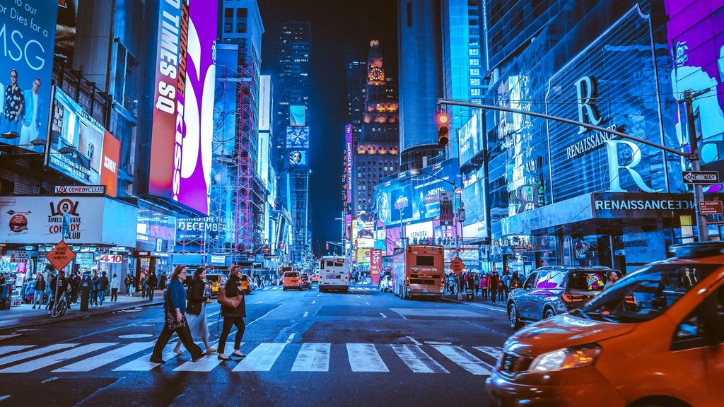
New York City weather officials have issued urgent flash flood warnings as powerful thunderstorms sweep across the East Coast. Heavy rain and intense downpours threaten to flood streets, disrupt subway lines, and create dangerous travel conditions for millions of residents from Maryland up to Connecticut.
City leaders and emergency management teams urge residents to take storm alerts seriously, prepare their homes, and avoid unnecessary travel while the storm passes. With rainfall rates potentially reaching up to two inches per hour, low-lying neighborhoods and basement apartments face the highest risk of sudden flooding.
Here is everything you need to know about the current weather warnings, the risk factors in urban areas, and practical steps you can take to stay safe.
What Is Happening Right Now on the East Coast?
A fast-moving storm system is bringing heavy precipitation, strong winds, and severe lightning across the Atlantic seaboard. Weather forecasters note that a combination of warm, muggy air and an incoming atmospheric disturbance created ideal conditions for torrential rain.
The National Weather Service put several major metro areas under flood watches and warnings. This includes New York City, parts of Long Island, northern New Jersey, and eastern Pennsylvania. In many places, the ground is already saturated from earlier rains, which means new rainwater has nowhere to go.
The $0 Secret To Launching Your Entire Online Empire
Why pay hundreds every month for separate software? Build funnels, send emails, and make sales with Systeme.io completely free.
Get Started For $0Free Forever • No Credit Card Needed • Beginner-Friendly
When rain falls faster than the ground can absorb it, water rises quickly on roads and sidewalks. That rapid surge of water creates what weather experts call a flash flood. Unlike gradual river flooding, flash floods happen with very little notice, making them extremely dangerous for drivers, commuters, and people living below street level.
City agencies have activated response teams to clear catch basins and monitor vulnerable spots. Even so, officials emphasize that residents must stay informed by following updates from official sources like NYC Severe Weather.
Understanding Flash Floods: Why Cities Face Extra Danger
Flash floods sound like ordinary rainstorms, but they carry far more risk. In rural areas, soil and open grass act like giant sponges that soak up water. In a major city, concrete, asphalt, and rooftops block rain from soaking into the ground.
That water flows directly into street gutters and storm sewers. When intense downpours dump several inches of rain in just one or two hours, city drainage systems quickly become overwhelmed. Water backs up onto roadways, surges into intersections, and spills into subway entrances.
Why New York City Infrastructure Is Vulnerable
New York City has one of the oldest and largest urban drainage networks in the country. Many underground pipes were built decades ago to handle moderate storms, not modern extreme weather events.
Subway stations sit well below street level, making them natural collecting basins for runaway surface water. When storm drains fill up on the street, water flows down stairwells and through ventilation grates directly onto tracks and platforms.
Basement apartments present another major concern. Thousands of residents live in below-grade apartments across Queens, Brooklyn, and the Bronx. During sudden downpours, water can rush down driveway slopes or back up through floor drains, trapping residents inside before they realize what is happening.
How Modern Tech and AI Help Predict Storms
Weather forecasting has come a long way in recent years. Today, meteorologists use satellite data, advanced radar networks, and machine learning models to track storms in real time.
Artificial intelligence algorithms help predict exact rainfall totals down to specific neighborhoods hours before the first drop falls. If you want to learn more about how smart systems and digital tools shape our daily life, explore our guide on Technology and AI.
These smart tools give city officials early warning signals so they can deploy emergency crews, position water pumps, and issue public safety notifications much faster than in the past.
Key Regions Affected by the Current Weather Alert
The current storm system covers a wide footprint along the East Coast, affecting tens of millions of people. While the severity varies from block to block, several main zones face the highest flood risk:
- New York City Five Boroughs: Queens, Brooklyn, Manhattan, Staten Island, and the Bronx all face potential street flooding and transit delays. Low-lying areas in Queens and Brooklyn remain on high alert.
- Long Island: Eastern Nassau and Suffolk counties expect heavy downpours that could lead to ponding on highways and coastal lowlands.
- Northern and Central New Jersey: Major utilities have reported localized power outages as wind and heavy rain knock down tree branches onto power lines.
- Eastern Pennsylvania and Delaware: Communities along river basins and urban corridors have received flood watches through the afternoon.
- Southern Connecticut: Coastal areas face a mix of rain runoff and high tide surges that can flood waterfront roads.
Utility companies are asking residents to report any downed wires immediately and to stay far away from standing water near power equipment.
Practical Safety Steps for Homeowners and Renters
Taking quick, practical precautions can protect your family and your property when severe weather strikes. You do not need expensive equipment to prepare your living space.
Protecting Your Living Space
Start by inspecting the area around your building if it is safe to do so. Clear leaves, trash, and loose debris from outdoor drains, rain gutters, and window wells. Blocked drains force water to pool against foundations and doors.
If you live in a basement or ground-floor unit, take these immediate steps:
Send, Spend & Hold Money Worldwide Without Hidden Fees
Transfer money internationally at the real exchange rate and hold 40+ currencies in one account.
Open a Wise AccountMid-market rate • Fast transfers • 40+ currencies
- Move high-value electronics, documents, and personal belongings off the floor onto high shelves or tables.
- Elevate furniture using sturdy blocks if water typically trickles under your door during heavy rain.
- Check your sump pump if your building has one, and ensure the discharge pipe points away from the walls.
- Keep a battery-powered flashlight and fresh batteries nearby in case electric power drops out.
- Identify a safe exit route to an upper floor or outdoor high ground in case water enters rapidly.
City agencies have opened safe overnight shelters for residents who feel unsafe in ground-floor or basement housing. If water begins entering your home, do not wait. Pack essential items and move to higher ground right away.
Safe Driving and Commuting During Flash Floods
Traveling during a severe storm requires extra caution. Roadways can go from completely dry to deeply submerged in a matter of minutes.
The Danger of Driving Through Standing Water
The most dangerous thing any driver can do during a flash flood is drive through standing water. It is almost impossible to judge the depth of a puddle on a flooded street.
Water just six inches deep can reach the bottom of standard cars, causing loss of control and engine failure. Twelve inches of moving water can float small cars, while two feet of rushing water can sweep away trucks and SUVs.
Road surfaces can also wash away underneath floodwaters, leaving hidden sinkholes that trap vehicles. If you see a flooded street or a road closed by emergency markers, turn around and find a different route.
Navigating Public Transit Delays
During heavy downpours, public transportation networks often slow down or alter service to keep passengers safe. Subways may skip stations where water pools on platforms, and bus routes may detour around flooded underpasses.
Before leaving your home or office, check live service alerts from regional transit authorities. Give yourself extra travel time, wear waterproof shoes, and avoid waiting near open stairwells or ground grates where sudden water rushes can happen.
Building an Essential Storm Emergency Kit
Having a simple emergency kit ready gives you peace of mind during severe weather warnings. You do not need complex gear; standard household items will keep you prepared for power outages or temporary travel delays.
Your basic storm kit should include:
- Drinking Water: Keep extra bottled water stored for each person in your home.
- Non-Perishable Food: Stock simple snacks, canned goods, and a manual can opener that do not require cooking or refrigeration.
- Lighting Supplies: Keep bright LED flashlights or battery lanterns handy. Avoid using candles during storms because open flames pose fire hazards if power outages occur.
- Portable Power Banks: Charge your cell phone, laptop, and backup power banks completely before the storm arrives.
- First Aid Essentials: Keep bandages, antiseptic wipes, pain relievers, and extra prescription medications together in a waterproof bag.
- Important Documents: Store IDs, insurance papers, and emergency contact lists in sealed plastic bags.
Keep your emergency supplies in a central, easy-to-reach spot so you can grab them quickly if you need to leave your living space.
The $0 Secret To Launching Your Entire Online Empire
Why pay hundreds every month for separate software? Build funnels, send emails, and make sales with Systeme.io completely free.
Get Started For $0Free Forever • No Credit Card Needed • Beginner-Friendly
How Digital Media and Creators Share Real-Time Weather Updates
During extreme weather events, traditional news broadcasts are no longer the only way people get live info. Digital content creators, meteorology channels, and local vloggers stream live weather updates and storm coverage straight to mobile devices.
Platforms like YouTube host thousands of independent channels that explain storm patterns, showcase live street conditions, and teach practical home repair skills. If you are interested in how modern online channels produce high-volume content during trending events, check out our guide on YouTube Automation.
Social video platforms help emergency responders broadcast safety warnings rapidly to younger audiences who might not watch traditional network news. Seeing live video feeds of flooded streets also helps drivers avoid hazardous intersections in real time.
How Local Emergency Services Respond to Storms
When flash flood warnings go into effect, city departments coordinate to keep public spaces safe and functional.
Emergency management teams clear catch basins across high-risk neighborhoods to help rainwater drain as fast as possible. Sanitation crews collect loose street debris before rain begins, while fire and police departments position high-water rescue vehicles in low-lying zones.
City workers also monitor critical infrastructure like electrical sub-stations, water treatment plants, and highway underpasses. When severe water pooling occurs, emergency crews use heavy-duty mobile pumps to clear standing water off main arterial roads.
If you notice blocked catch basins, overflowing street drains, or fallen tree limbs in your neighborhood, you can report them directly to local non-emergency city hotlines like 311. Reporting small issues early helps crews clear blockages before water backs up into surrounding homes.
Environmental Factors behind Heavy Summer and Autumn Rainstorms
Many people wonder why intense rainstorms seem more frequent and powerful during late summer and early fall. The answer lies in how atmospheric temperature affects ocean moisture levels.
During warm months, high temperatures cause sea surface water to evaporate rapidly. Warm air holds significantly more moisture than cool air. When a cold front moves down from Canada and collides with warm seaboard air, that stored moisture turns into intense rainfall over a short timeframe.
Urban heat island effects also play a role. Large metropolitan areas retain heat in asphalt and concrete, keeping air temperatures higher over cities than in surrounding rural fields. This extra warmth can boost rising air currents, making local rainstorms hit with even greater intensity.
Understanding these atmospheric patterns helps urban planners build smarter green infrastructure, like rain gardens, porous pavements, and bioswales that catch stormwater naturally.
Frequently Asked Questions
What is the difference between a flood watch and a flood warning?
A flood watch means conditions are favorable for flooding to develop in your area. It serves as an early notice to prepare. A flood warning means flooding is already happening or will happen very soon. When a warning is issued, you should take immediate action to stay safe.
Why are basement apartments dangerous during flash floods?
Basement apartments sit below ground level, where gravity pulls surface runoff water. During intense downpours, storm drains on the street can overflow, sending water rushing down steps, window wells, or floor drains. Water levels can rise within minutes, blocking doors and window exits.
Is it safe to drive through small puddles on the highway?
It is best to avoid driving through standing water whenever possible. Puddles can hide deep potholes, missing manhole covers, or sharp debris. Additionally, splashing water into your engine compartment can damage electrical wiring or stall your car engine.
What should I do if water enters my home?
If water starts entering your home, turn off main electrical breakers if you can safely reach them without standing in water. Move quickly to an upper floor or higher ground. Call 911 immediately if water rises rapidly or if you become trapped.
How can I get official emergency alerts on my mobile phone?
You can sign up for free local emergency alert services like Notify NYC or your local county alert system. Most smartphones also have Emergency Alerts enabled by default in system settings to receive urgent severe weather warnings from the National Weather Service.
Final Thoughts
Flash flood warnings serve as a clear reminder of how fast coastal weather conditions can change. Heavy downpours bring real hazards to city streets, public transit, and home living spaces. Staying safe comes down to early preparation, paying attention to official weather alerts, and avoiding risky choices like driving through flooded streets.
Take a few minutes today to check your home drains, secure your valuables, and charge your personal electronic devices. Look out for neighbors, especially elderly individuals or those living in ground-floor and basement apartments. Simple actions taken early make a huge difference in keeping everyone safe during severe weather events.
To learn more about our mission to keep readers informed, visit our About Us page or reach out directly through our Contact Page. You can also follow us on social media for daily updates and community discussions on Instagram, Facebook, and X. Stay alert, stay prepared, and stay safe out there!
